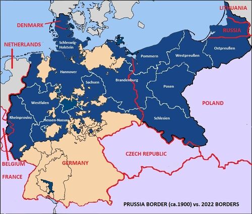
In this image:
Where: [location?]
When: [date?]
Uploaded: 10 Dec 2022 by Skye Sonczalla.
Comments: 3, WikiTree Popularity: 1.
Original digital image: 800 x 679 pixels. GIMP 2.10.24 software. Dated 2022:12:10 11:45:26.
Do you love this photo? Maybe it's just interesting, or there's a story behind it? Please share it with the WikiTree community.

This image is open for viewing but you need to be logged in to edit the details. Please login here.

I believe that it is very important to identify clearly the date when this representation was accurate. I am guessing that the source maps were drawn around 1905. It seems to me very similar to the boundaries I can see in https://www.meyersgaz.org/
edited by Steve Thomas
Edit of image to include labels by Skye Driggs 10 Dec 2022. Permission is not needed to copy, duplicate or edit this map.
edited by Skye Sonczalla