
Pennsylvania Maps
- Profile
- Images
Date:
[unknown]
[unknown]
Location: Pennsylvania
Surname/tag: Nescopeck,Wapwallopen,Sugarloaf,Butler,Lehigh,Berks,Luzerne
Location: Pennsylvania
Surname/tag: Nescopeck,Wapwallopen,Sugarloaf,Butler,Lehigh,Berks,Luzerne
This page has been accessed 958 times.
Variety of different Pennsylvania maps that have information that is useful to genealogy research.

|
| Genealogy map of the counties of Pa |

|
| 1873 map of Luzerne county showing townships |

|
| Original land warrants for lower Luzerne Co,includes Nescopeck,Hollenback,Conyngham,Butler,Sugarloaf,Black Creek and Hazle |
Contents |
Melish Whiteside maps
These maps were commissioned by the state legislature about 1820,they show different points of interest that can be useful to genealogy research,towns,churches,forts,etc.
Land Warrant Maps
Berks Co
Luzerne Co
- Nescopeck Twp
- Black Creek Twp
- Butler Twp
- Salem Twp
- Hazle Twp
- Hollenback Twp
- Sugarloaf Twp
- Dorrance
- Conyngham Twp(Wapwallopen)
Columbia Co
1873 township/town maps
- Eckley
- Nescopeck Twp
- Hollenback Twp
- Sugarloaf Twp
- Black Creek
- Butler Twp
- Hazle Twp
- Dorrance Twp
- Newport Twp
- Slocum Twp
- Upper Lehigh
- Wright Twp
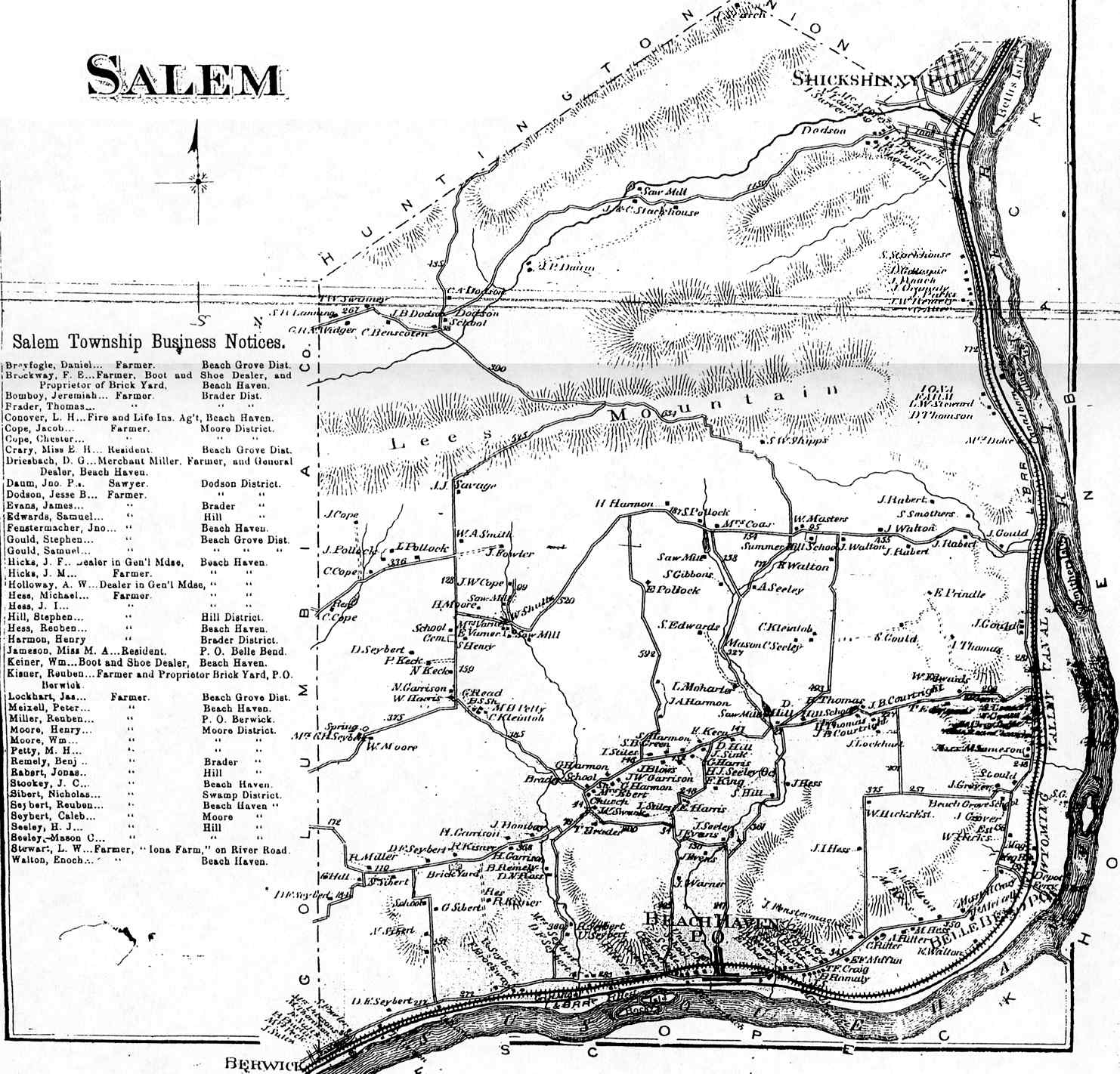
- Salem
Pa Coal Region
Images: 34


Collaboration
- Login to edit this profile and add images.
- Private Messages: Send a private message to the Profile Manager. (Best when privacy is an issue.)
- Public Comments: Login to post. (Best for messages specifically directed to those editing this profile. Limit 20 per day.)
Comments
Leave a message for others who see this profile.
There are no comments yet.
Login to post a comment.